
Home/Active Page
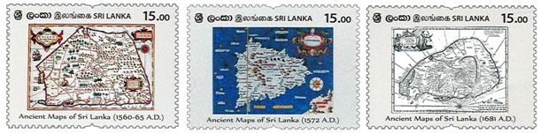
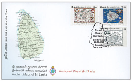
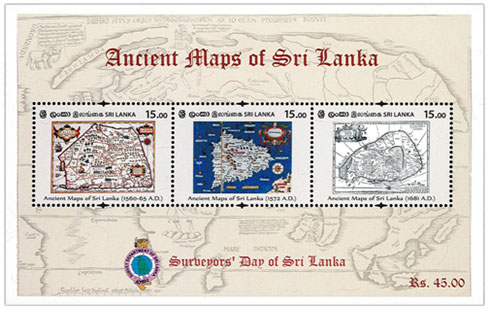
The Philatelic Bureau of the Department of Posts has Issued three new postage stamps and a souvenir sheets, in the denominations ofRs. 15.00 each, on 22nd March, 2020, that depict ancient maps of Sri Lanka.
| Date of Issue | September22nd, 2020 |
| Denomination | Rs.15.00 x 3 |
| Catalogue No: | Rs.15.00 - CSL 2397 Rs.15.00 - CSL 2398 Rs.15.00 - CSL 2399 |
| Stamp Designer | P.Isuru Chathuranga | Stamp Size: | 41mm x 30mm |
| Sheet Composition: | 20 stamps per sheet |
Eratosthenes of Cyrene (284 - 194 BC - Alexandria) was Greek polymath renowned for the study of geography and is known for being the first person to calculate the circumference of the Earth, which he did by comparing angles of the mid-day Sun at two places, a known North-South distance apart. He was also the first to calculate the tilt of the Earth's axis. Both these calculations were remarkably accurate. He created the first global projection of the world, in which Sri Lanka too is depicted. In this map Sri Lanka is called Taprobane. We know that there were subsequent Greek and Roman maps. For example there is a reference to a world map, an orbispictus, in a speech by Eumenius, an Ancient Roman panegyrists. Apparently this map was on display in a school in Augustodunum, Gaul (now France) in the 3rd century. However most of them have been destroyed.
Around 1595, Cypriano Sanchez, a Spanish cartographer who was working for Portuguese map makers in Lisbon, produced this map of Sri Lanka, pentagonal in shape and fairly detailed in its description. This map was included in the famous Mercator's Atlas in either the 1619 or 1630 edition. This map does not depict Colombo, however it has detailed topographical notes and depicts at various points, of the type of vegetation and the animals special to the district. In this remark this map is quite different from TTomasoPorcacchiCastilione's map circa 1572 AD.
Early Roman, Arab, medieval European and Asian maps do not depict the true shape of Sri Lanka in its maps. These maps also contain inaccurate or incomplete depictions of rivers, mountains and other geographical features. However Tomaso PorcacchiCastilione's (1530 – 1585 AD) map is a marked improvement in these aspects.
Out of the three maps depicted in the stamps, this map, drawn by Robert Knox is the most accurate one. Knox, who was a sailor, was taken captive in 1659 by the troops of King Rajasinghe II king, who ruled Kandy at that time. Knox lived 19 years in Sri Lanka and had an extensive understanding about the country. This helped him to create a more accurate map. This was also one of the first maps in English. The central highlands, most of the rivers and cultivations, lagoons and ports around the country are fairly accurately depicted on the map.
All rights reserved. All right to identify the Department of Posts as the Author and designer of this Bulleting has been asserted in accordance with the Copyright, Design and Patents Act 1988.No part to this publication may be reproduced, stored in or introduced into a retrieval system, or transmitted in any form or by and means (electronic, mechanical, photocopying, recording or otherwise) without the prior permission from the publisher. Any person who does and unauthorized act in relation to this publication may be liable to criminal prosecution and civil claims for damages.